AVIATION ACCESS TO BE IMPROVED AT CHILDS GLACIER, ALASKA
The Recreational Aviation Foundation is pleased to announce good news for Alaskans and visitors to Alaska seeking access to a US Forest Service campground facing Childs Glacier. On January 31, RAF Alaska Liaison Al Clayton received approval from the US Forest Service for his RAF request for $50,000 to improve and expand the small airstrip just north and east of the glacier’s massive face. “We’re super excited about this good news,” Clayton said.
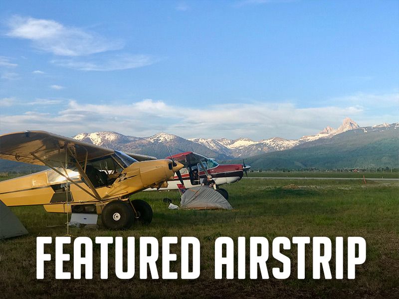
Clayton, a life-long Alaskan, grew up near the headwaters of the Copper River and worked one summer for Alaska Department of Fish and Game at this location during college. He explains, “The Childs Glacier calves icebergs into the Copper in July when the sockeye run is hot, sending huge waves across the narrow river, sometimes washing salmon up into the alder bushes. This is the natural take-out at the end of a multi-day Copper River rafting trip upstream from Kennicott or Chitina. The scenery and topography are stunning. It is truly a world class location.”
This airstrip lies just north of the 1910 “Million Dollar Bridge” constructed as part of the Copper River & Northwestern Railroad which provided the first rail access from the tidewater port of Cordova, Alaska to interior Alaska. The rail line helped tap the incredibly rich Kennicott copper deposit developed by Stephen Birch with financial support from New York’s Guggenheim and Morgan families. “Books have been written on the challenges of bridge and trestle construction over glacial moraine; and the mining operations that developed in the area. The last ore train ran in 1938, and the towns of Kennicott and McCarthy emptied and alders started reclaiming the railroad right of way,” Clayton added.
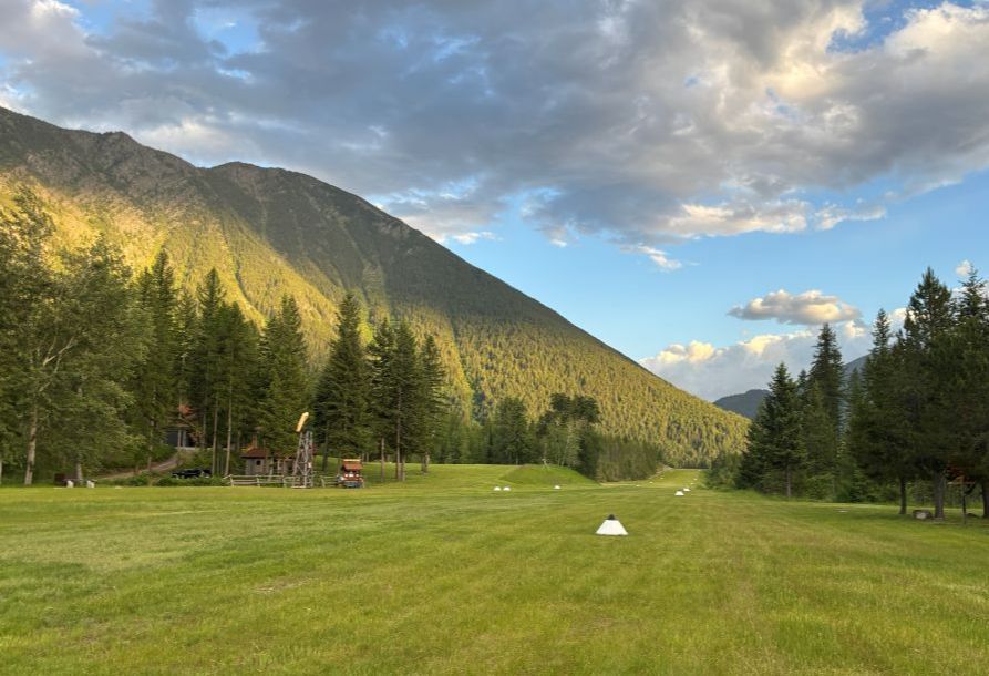
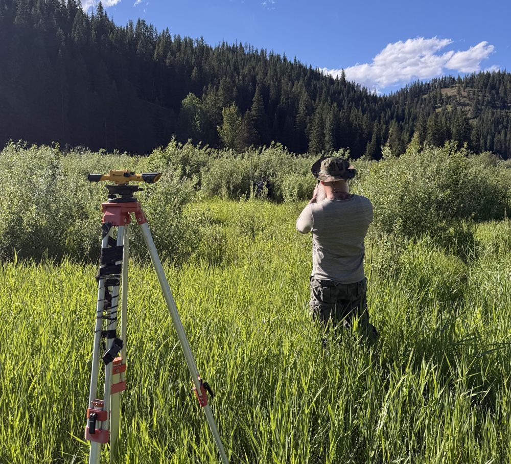
Eventually the right of way was conveyed to the State of Alaska. Fifty-two miles of rail outbound from Cordova were removed and the resulting road to Childs Glacier and the bridge was accessible by motor vehicle. After the 1964 earthquake, the State invested in bridge repairs and the Forest Service built a beautiful campground south of the bridge and across the river from the face of the Childs Glacier. However, modern washouts have destroyed bridges downstream from Million Dollar Bridge, and today the only access to a campground and bridge is over the treacherous river by riverboat; or the present short and narrow “Cub” strip. Adding 400 feet to its north end and cutting cottonwood trees from additional 200 feet will yield a reasonably safe bush strip, according to Clayton’s proposal.
The Recreational Aviation Foundation thanks AOPA and Alaska Airmen’s Association for their support of this project, and is proud of its history of creating and improving airstrips for recreational access.
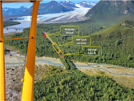
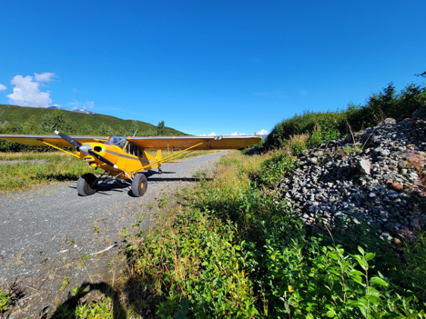
Large rock piles 22′ from airstrip center line
Limited runaround area at north end
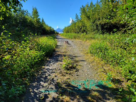
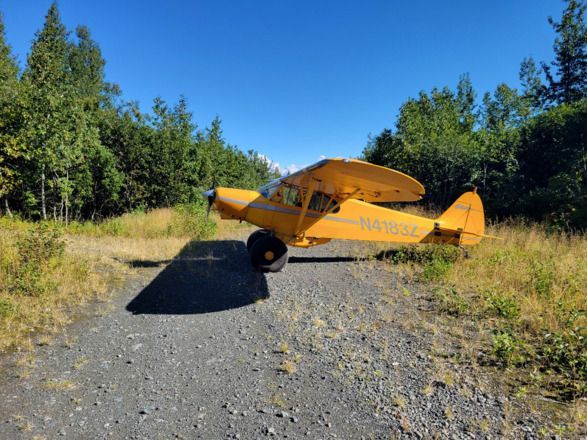
Brush at the north end
Photos by Troy Tirrell
Submitted on February 3, 2022.
Posted in News
Recent Posts