COOPERATION WITH PARKS DEPARTMENT LEADS TO STRIP IMPROVEMENTS
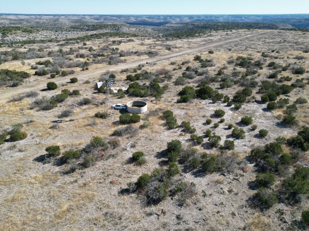
Since the RAF signed an MOU with the Texas Parks and Wildlife Department, RAF Texas Liaison Tres Clinton reports they have had numerous in-person and online meetings, and the department supports airstrips on Parklands. So far, work has been completed at Del Norte airstrip, in the Devils River State Natural Area.


“The main focus now is West Texas,” Clinton said. “We have been working with Asa Vermeulen, Devils River State Natural Area Complex Superintendent, and Adam Jarrett, West Texas State Parks Regional Director, who have direct control over the specific target areas,” Clinton said.


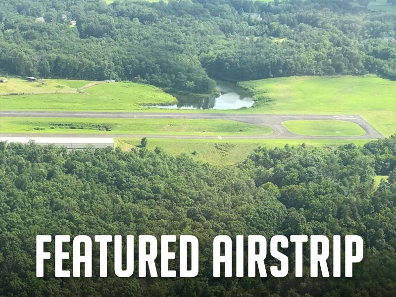
Former Texas State Representative John Cyrier has been instrumental in advocating for recreational airstrips on Park lands, and he and Clinton flew out to Del Norte to check out the recent work. This neglected strip became unlandble last spring due to trees and cactus growth. “Asa Vermeulen gets the credit for all of the work to turn this into a useable 1,600-ft strip,” Clinton said. “Our purpose was to check out the work accomplished, the condition of the strip, decide parking and camping areas, to deliver a windsock and frame, and mostly to say ‘thank you’ for all of their hard work,” he said. A few trees will be cleared for the parking area, and Vermeulen is looking into natural or seeded ground cover options to retain its status as a Natural area. “Currently they do not allow fires but we are negotiating this as well, Clinton added.
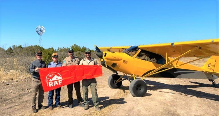
“Our immediate goals with Del Norte are to finish clearing the camping areas, finalize rules, get the windsock up, update information with the FAA and Foreflight, and list in the Airfield Guide, and get a state-funded composting toilet, and plan a grand opening,” Clinton said.


The other airstrip within the Devil’s River Natural Area is Dan Allen Hughes with a hike to river access. Dan Allen is about 3,800 feet and paved. “The two strips are about an hour and-a-half drive, and literally a six minute Cub flight from each other.” Clinton said. “Del Norte is more scenic with some amazing overlooks.” Dan Allen is undergoing about $15 million in Parks improvements, including a common area with showers and restrooms walking distance from the airstrip. Clinton is exploring specific improvements and delivered a windsock and frame. “I’m excited about the progress.” Clinton said. “The future looks good.”


Submitted on February 10, 2023.


Posted in News

    Recent Posts
August 5, 2026
FEATURING: TOOL ROLLS Whether you’re heading to the hangar, the backcountry, or your next work party, staying organized matters. The RAF Tool Roll keeps your essential tools secure, accessible, and ready when you need them most. Designed to fit conveniently in your airplane or vehicle, it features multiple zippered pouches, labeled compartments, and a durable roll-up design with built-in handles for easy transport. No more digging through a loose toolbox or searching for that one tool you need. Keep your gear organized to spend less time looking and more time flying!
By Carmine Mowbray July 31, 2026
Landing and camping at Taylor Flat airstrip puts your tent only a stone’s throw from the wild and scenic Green River, as it carves through spectacular Utah canyons. You can tie down and camp under your wing along the north side of the airstrip, or walk to the river and camp. Just 34 nm northeast of Vernal, you can now land at this high, remote BLM airstrip and enjoy its world-class fly fishing, but be sure to get your license before you arrive. If you packed your kayak or inflatable, there’s a boat ramp just west of the public campground. An easy 1.8-mile walk from the airstrip takes you to the historic 1880 John Jarvie Ranch, an open-air museum with hands-on exhibits showing pioneer ranch life in this remote northeast corner of Utah. This airstrip had lain dormant for thirty years, and is now open for public non-commercial use, thanks to pilots who recognized its special recreational value. The RAF worked through the steps to see that the BLM reopened it. One restoration work weekend brought twenty-five volunteers from both Utah Back Country Pilots (UBCP) and the RAF who hand-picked rocks from the airstrip, painted them, and used them to mark the runway corners and thresholds. UBCP provided a new windsock pole for the new RAF windsock. RAF Utah Liaison Wendy Lessig said, “It was another demonstration of working together toward the same goal.” There are no other amenities, so be prepared with what you need, and as always, please pack everything out. Those using the airstrip are asked to be mindful of the sensitive environmental area, marked with 16-ft X’s, creating a displaced threshold on the east end of the dirt runway. The useable runway length is 2,500 feet, and the field elevation is 5,630. The area east of the runway is hazardous to aircraft operations. In addition to being a sensitive environmental area, it. is cross-crossed with ditches, and is not safe for aircraft use. Taylor Flat is another special recreational destination for pilots to visit as RAF works across the country on Expanding The Map! Find more on Taylor Flat in the Airfield Guide . You may also find user reports here on the UBCP website . Submitted July 31, 2026 By Carmine Mowbray
July 30, 2026
RAF Maine Liaison Andy Rowe and former Maine Liaison/now Ambassador Steve Mason have long been advocating for and organizing improvements at several airfields in North Maine, in cooperation with North Maine Woods (NMW). Rowe was awarded an RAF grant for materials to add a shelter, picnic table, and outhouse at Estcourt Airfield (19ME) and organized RAF and NMW volunteers to provide labor.
July 29, 2026
The new Fly Rocky Top airstrip network, developed by the Recreational Aviation Foundation (RAF), is now open to backcountry aviation enthusiasts. Located in East Tennessee, Fly Rocky Top is a "basecamp and outpost" concept for regional aviation exploration, adding the Southeast to a growing collection of well-recognized recreational airstrip networks across the country, including Fly Oz in Arkansas and others in the West and Southwest. Fly Rocky Top is the most significant achievement to date of the RAF's Expanding the Map initiative, a nationwide effort focused on opening, improving, and restoring access to airstrips, helping connect aviators to more of the places they love to explore. Named and inspired by local culture, each Fly Rocky Top airstrip has unique features, amenities, and recreational options that embody the mission and spirit of the RAF. The new network is in the heart of a region nationally recognized for its unique topography that includes the Obed Wild and Scenic River, Big South Fork National Recreation Area, Cumberland Plateau, and Great Smoky Mountains… altogether a landscape uniquely suited to backcountry aviation. Rockwood Municipal Airport, RKW, anchors the network with its 2,400-ft manicured turf landing area and is designed with backcountry flyers in mind. Rockwood Aviation, which operates RKW, offers products and services for pilots to engage in tailwheel, backcountry, and recreational flying, including training, service, and support. City of Rockwood Mayor Jason Jolly highlighted the significance of Rockwood Airport to the community and East Tennessee. Mayor Jolly said, "We are a national recreation destination and the progress at Rockwood Airport and the surrounding network of airstrips is just the latest step in our region's growth and development for adventurers and enthusiasts." The Fly Rocky Top network is unique in that the initial collection of airstrips – with more planned – are a combination of both public lands and privately owned property with the common desire to welcome the flying public. Specific new airstrips in the Fly Rocky Top network include Smuggler's Landing, a grass landing area at RKW (with tent camping and a welcoming pavilion planned), McGraw's Backyard (5TN4), Robbin's Farm, and Tellico Plains (85TN). An additional outpost, Sawbriar, will be ready in August 2026. More airstrips are in the process of being added and will appear on the Fly Rocky Top webpage . Plans continue to add amenities to each RAF Fly Rocky Top airstrip, including accessible flush toilets and timber-framed shelters where camping is available. Other attractions include access to world-class upland bird hunting, hiking, some of the nation’s best trout fishing, kayaking/canoeing on the Clinch and Tennessee Rivers, and a 44-mile Water Trail on Beaver Creek. Select airstrips have access to meals and accommodations. RAF Co-founder and Chairman John McKenna highlighted what makes this opening so important. “Fly Rocky Top is not just a new airstrip network; it’s also a group of pilots who are passionate about aviation, stewardship, and the great outdoors,” he said. “Fly Rocky Top will connect Southeast pilots, landowners, and outdoor enthusiasts alike with the shared mission to preserve access to the region's wild beauty and outdoor recreational opportunities.”
July 29, 2026
RAF Montana Liaison Scott Newpower organizes the annual Montana Pilots Association and RAF cooperative work party at Schafer Meadows USFS airstrip, and on Saturday, July 18, nearly two dozen volunteers flew in to help. The airstrip lies in the Great Bear Wilderness, so work is limited to hand tools. A special thanks to Montana Aeronautics Aviation Support Officer Stephen Torske and the team at MT Aeronautics for their support.