DOING OUR PART TO PRESERVE WILDERNESS ACCESS

A field with a mountain in the background and trees in the foreground

Did you know there are now 803 Wilderness Areas covering more than 111.7 million acres in the continental US and Alaska? The US Forest Service manages the majority of these areas, followed by the Bureau of Land Management, the National Park Service, and US Fish and Wildlife Service. There are even more Wilderness Study Areas, (WSAs) with wilderness characteristics that make them eligible for designation as Wilderness. The BLM alone has 487 WSAs.


The Wilderness Act of 1964 defines these areas as “where the earth and its community of life are untrammeled by man. . .” They are managed with the government’s highest level of land protection and are non-motorized areas. Aircraft are an exception to the non-motorized rule, as continued public use of aircraft was granted for airfields that existed prior to the Wilderness Act being enacted.


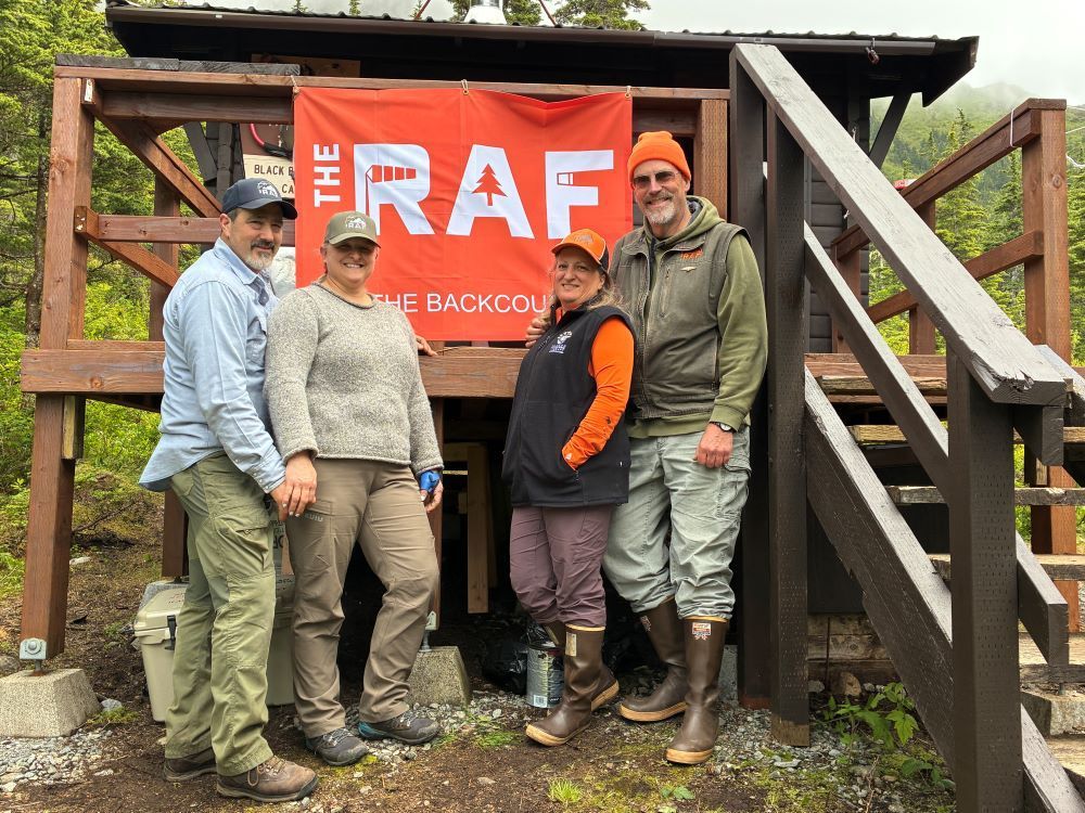
In the interest of preserving aviation access to these special places, the RAF Backcountry Etiquette Team (BET) has engaged in outreach and education. Lynn Mareth, chair of the RAF BET points out, “The Wilderness Act of 1964 permits the use of aircraft in wilderness areas already established, but the Secretary of Agriculture can restrict access at any time.” Her concern is supported by the official record. The four federal agencies have publicized that they are moving toward implementing what they formally define as Wilderness Character, the path toward more restrictive Wilderness management.


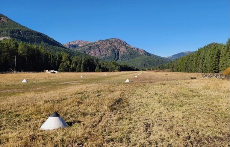
Knowing where Wilderness is, and practicing good backcountry etiquette helps ensure continued access. Your chart marks Wilderness Areas with solid/dotted blue lines, and they look similar to National Recreation Areas, but the name of the Wilderness will be within the border. This marking does not appear on the chart legend.


In these areas, it is important to practice Leave No Trace, and, when safe to do so, minimize your noise signature, as others in the vicinity seek quiet surroundings. And of course, land and stay a while, to fully enjoy the special qualities Wilderness areas have to offer.


For more suggestions, see the RAF Code of Conduct.


Submitted on December 11, 2024.
By Carmine Mowbray


Posted in News

Recent Posts

March 30, 2026
As you're planning your 2026 flying adventures, remember to review safety briefings for the airstrips you plan to visit. The RAF strongly recommends you review safety briefings and print a copy to have in your airplane - it's even required to fly into some airfields, like Ryan Field (2MT1). For those airfields, pilots flying in are required to review the briefing on an annual basis, and now is the perfect time to catch up on any changes to the runway/area that happened throughout the winter. You can find safety briefings on the RAF Airfield Guide . If an airfield in the Airfield Guide has a required briefing, the airfield listing will clearly indicate it and have a tab to view the briefing. Submitted March 30, 2026 Photo By Jim Stevenson
March 30, 2026
RAF Texas volunteers and Ranger Airfield Foundation volunteers helped begin restoration of the historic 1928 Ranger Airfield hangar on March 28. “A Wright biplane landed here at the field in 1911, and people have been using it ever since,” Ranger Airfield Foundation Founder Jared Calvert said. He noted that Amelia Earhart landed there in a Pitcairn Auto Gyro. Richard Bach, Pancho Barnes, and General Patton also landed at the field. It’s the oldest continuously used turf field in Texas. 
By Carmine Mowbray March 30, 2026
For adventurers seeking access to the Gila Wilderness, we suggest landing at Sacaton Airstrip, NM16, near Buckhorn, New Mexico. The runway lies on a “finger mesa,” and the Rain Creek trailhead lies just northeast of the field. Thanks to RAF New Mexico Liaison Ron Keller's coordination with the USFS using a Cost Share Agreement, Keller was able to organize RAF and New Mexico Pilot Association (NMPA) volunteers to rehabilitate and reopen the long-abandoned airstrip in 2022. Beyond reopening the airstrip, Keller added camping amenities, including picnic tables and a new vault toilet. Most recently, Keller oversaw the installation of new shade structures, most welcoming to campers and hikers. RAF and NMPA volunteers complete ongoing maintenance at Sacaton and other airfields in the Gila National Forest. You’ll see white-painted rocks along Sacaton’s 3,989-ft dirt runway, and surrounding the segmented circle near the RAF windsock. The airstrip lies at 6,200-ft elevation, so pilots should be mindful of density altitude while flying over high terrain in the vicinity, even in winter temperatures.  “Anglers will enjoy plying streams for the rare native copper-colored Gila trout, once a threatened species,” Keller reports. The mile-and-a-half trail to the crossing at Rain Creek is narrow and challenging and traverses a variety of terrain, but the serious hiker will be rewarded trekking through steep canyon walls lined with green alder, willow, and boxelder, hoodoos, and eagle aeries above. There are rumors of a double waterfall some distance on the west fork of Rain Creek trail. See the Sacaton page in the Airfield Guide for more details. Note that the airstrip may be unusable due to snow or after heavy rains. This runway should be considered one-way in/one-way out to avoid overflying the Wilderness boundary. There is a 4.6% upslope to the East, favoring landing Runway 08 with right traffic, remaining clear of the Wilderness east and north of the airfield. Please consider others seeking a Wilderness experience. Prior to landing at Sacaton, permission is required by calling the USFS Gila Dispatch center at 800-538-1644. Please familiarize yourself with Sacaton in the Airfield Guide and the New Mexico Pilots Association Safety Briefing . Submitted March 30, 2025 By Carmine Mowbray
By lellington March 29, 2026