FEATURED AIRSTRIP: PAYSON, ARIZONA

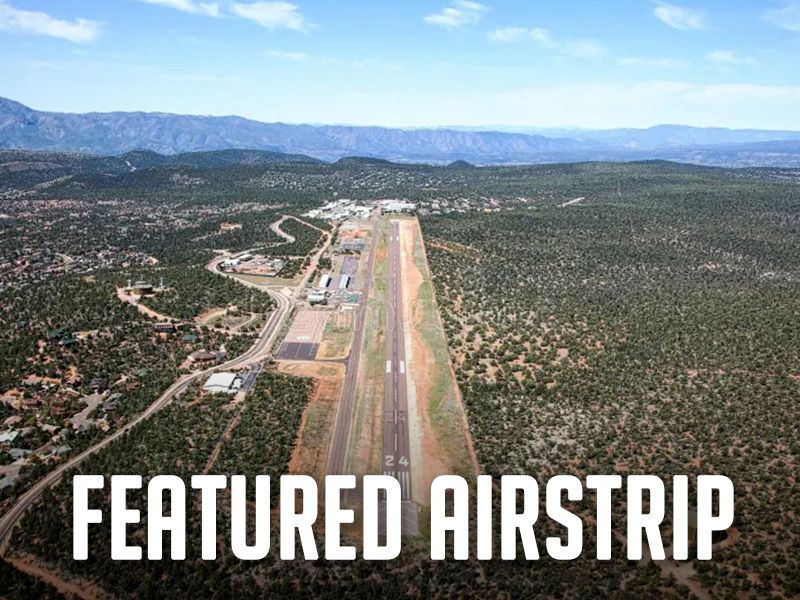
Payson, Arizona, is billed as “Arizona’s Cool Mountain Town,” and recreational aviators give it a big thumbs-up. The airport (KPAN) lies at 5,157 feet elevation beneath the Mogollon Rim and has become a favorite stop for pilots. It’s 50 miles from the hubbub of the busy Phoenix region, yet it offers all the amenities a recreational flyer could want – an uncontrolled, small-town airport – a natural stop for resupply for exploring Arizona’s other backcountry strips. It has 24-hr avgas and Jet A, and a courtesy car, available with 24-hour prior reservation, so you can explore the area and discover a wealth of outdoor recreation and historical sites, trails, and Native ruins.


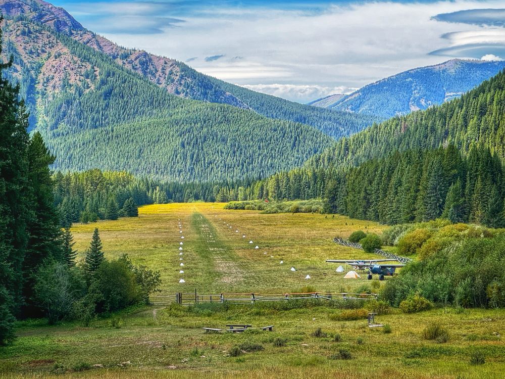
Camping among pinyon pines can start right at the Payson airport, where you’ll find a dozen campsites, each with a picnic table, grill, fire ring, and stocked firewood. Join new friends in the ramada, or around the group fire ring under the clear night sky. There are ADA restrooms with hot showers. The Crosswinds Restaurant is right on the airport and welcomes you for breakfast and lunch. Patrons highly recommend their pies.


Payson has a very active Parks and Recreation department that organizes events throughout the year. Of special interest to aviators is their annual Aerofair in October. Admission is free, and the ramp is lined with all kinds of vendors and displays. You may see a Marine VTOL demo, a T-34 formation flyover, or strap in a Huey or a Cobra for a helicopter ride. You can choose from a mouth-watering variety of local foods. Experience community spirit during other warm weather events like free movies in the park, pro rodeo weekends, and golf tournaments. Fall brings public 5K run-walk events, flag football, and hay rides; and Christmas is lit up with the annual parade of lights. Payson gleams with community pride, and you can see the full story here.


Find more about the Payson Airport in the Airfield Guide.


Submitted November 24, 2025


Posted in Featured AirstripNews

Recent Posts

March 30, 2026
As you're planning your 2026 flying adventures, remember to review safety briefings for the airstrips you plan to visit. The RAF strongly recommends you review safety briefings and print a copy to have in your airplane - it's even required to fly into some airfields, like Ryan Field (2MT1). For those airfields, pilots flying in are required to review the briefing on an annual basis, and now is the perfect time to catch up on any changes to the runway/area that happened throughout the winter. You can find safety briefings on the RAF Airfield Guide . If an airfield in the Airfield Guide has a required briefing, the airfield listing will clearly indicate it and have a tab to view the briefing. Submitted March 30, 2026 Photo By Jim Stevenson
March 30, 2026
RAF Texas volunteers and Ranger Airfield Foundation volunteers helped begin restoration of the historic 1928 Ranger Airfield hangar on March 28. “A Wright biplane landed here at the field in 1911, and people have been using it ever since,” Ranger Airfield Foundation Founder Jared Calvert said. He noted that Amelia Earhart landed there in a Pitcairn Auto Gyro. Richard Bach, Pancho Barnes, and General Patton also landed at the field. It’s the oldest continuously used turf field in Texas. 
By Carmine Mowbray March 30, 2026
For adventurers seeking access to the Gila Wilderness, we suggest landing at Sacaton Airstrip, NM16, near Buckhorn, New Mexico. The runway lies on a “finger mesa,” and the Rain Creek trailhead lies just northeast of the field. Thanks to RAF New Mexico Liaison Ron Keller's coordination with the USFS using a Cost Share Agreement, Keller was able to organize RAF and New Mexico Pilot Association (NMPA) volunteers to rehabilitate and reopen the long-abandoned airstrip in 2022. Beyond reopening the airstrip, Keller added camping amenities, including picnic tables and a new vault toilet. Most recently, Keller oversaw the installation of new shade structures, most welcoming to campers and hikers. RAF and NMPA volunteers complete ongoing maintenance at Sacaton and other airfields in the Gila National Forest. You’ll see white-painted rocks along Sacaton’s 3,989-ft dirt runway, and surrounding the segmented circle near the RAF windsock. The airstrip lies at 6,200-ft elevation, so pilots should be mindful of density altitude while flying over high terrain in the vicinity, even in winter temperatures.  “Anglers will enjoy plying streams for the rare native copper-colored Gila trout, once a threatened species,” Keller reports. The mile-and-a-half trail to the crossing at Rain Creek is narrow and challenging and traverses a variety of terrain, but the serious hiker will be rewarded trekking through steep canyon walls lined with green alder, willow, and boxelder, hoodoos, and eagle aeries above. There are rumors of a double waterfall some distance on the west fork of Rain Creek trail. See the Sacaton page in the Airfield Guide for more details. Note that the airstrip may be unusable due to snow or after heavy rains. This runway should be considered one-way in/one-way out to avoid overflying the Wilderness boundary. There is a 4.6% upslope to the East, favoring landing Runway 08 with right traffic, remaining clear of the Wilderness east and north of the airfield. Please consider others seeking a Wilderness experience. Prior to landing at Sacaton, permission is required by calling the USFS Gila Dispatch center at 800-538-1644. Please familiarize yourself with Sacaton in the Airfield Guide and the New Mexico Pilots Association Safety Briefing . Submitted March 30, 2025 By Carmine Mowbray
By lellington March 29, 2026